
Editor’s Note: Harlan Hambright is the architectural photographer who captured in both 2D and 3D the “Lay Low” project by Hefferlin + Kronenberg that appeared in the Spring issue of Residential Design. You can learn more about Harlan’s work in 3D here and about the equipment and software he uses here.
This year marks my 41st year of being an architectural photographer. There were no drafting jobs available when I graduated from the University of Tennessee School of Architecture in 1976, so I combined my new degree with a love of photography and never looked back. The role of successful architectural photography is to visually capture and effectively communicate the essence and experience of a space. There are implied limitations to doing that with a camera–on what used to be film–but we get around that the best we can by selecting lenses, proper and meaningful viewpoints, controlling or selecting lighting conditions, and a host of other variables and techniques.
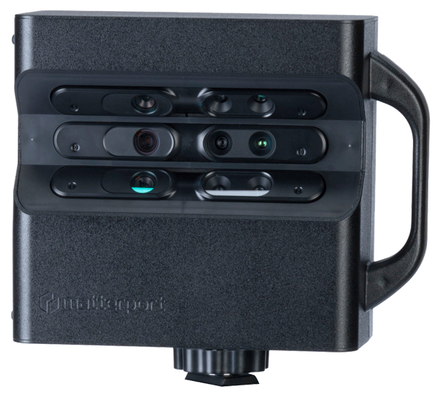
One shortcoming of traditional photography in capturing space is the absence of spatial awareness and the ability to move around to see, for example, how spaces relate to one another—how the experience flows. Matterport offered a solution to this deficiency three years ago with the release of its proprietary camera with 3D IR sensors and its cloud-based processing engine which produce online 3D models that can be virtually experienced just like walking through a project. I invested in the system two years ago and have since created nearly 400 tours for real estate sales, resort rentals, historic property tours, and design projects. The model produced by the system can be converted to a point cloud from which accurate as-built documents can be generated.
As a sales tool, several listings I have done sold very quickly after posting the tour. I work in a very active, high-end market on the Georgia Coast. A tour done last October resulted in a full-price offer in two days from a couple in Maine. The most interesting use to-date has been a tour up the 129-step climb to the top of the St. Simons Lighthouse. Disabled visitors to the museum can experience the trip from ground level on an iPad, making the lighthouse at least “virtually” accessible.
Production of a tour is quite interesting. The camera is controlled remotely via wifi by an iPad. The camera, mounted on a tripod, rotates 360 degrees capturing panoramic photo date and mapping the space in 3D. Each scan is beamed to the iPad where a floor plan is slowly generated. Every scan has to overlap a prior scan, and the app compares 3D data allowing it to place new scans in their proper locations. When you’re happy with the floor plan, the file is uploaded to the Matterport site where the heavy lifting is done, resulting in the finished, tourable file. These files can now be converted to and toured in VR.
While perhaps lacking the glamour of the traditional “hero image,” I believe this to be the most effective solution to communicating the actual experience of architecture to date, and VR implementation should make it more so.